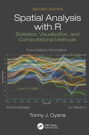
Course Overview
Spatial Analysis with R is a comprehensive course designed to equip participants with the skills and knowledge to perform spatial data analysis using R. R is a powerful open-source programming language and environment widely used in data science and statistical computing. This course covers the fundamentals of spatial data types, visualization, and analysis, focusing on practical applications in various fields such as environmental science, urban planning and epidemiology. This course aims to equip participants with the skills to harness the power of R for spatial data manipulation, visualization, and analysis.
Course Duration
10 Days
Who Should Attend
- Data analysts and scientists interested in spatial data.
- GIS professionals looking to expand their analytical toolkit.
- Urban planners and developers.
- Environmental scientists and researchers.
- Public health professionals.
- Epidemiologists.
- Students and academics pursuing degrees in geography, environmental science, or related fields.
Course Objectives
By the end of this course, participants will be able to:
- Understand the principles of spatial analysis and its applications across different domains.
- Develop proficiency in using R for handling and analyzing spatial data.
- Apply spatial analysis techniques to address real-world problems.
- Create spatial visualizations and maps for effective communication.
- Enhance decision-making processes through spatial insights.
Course Outline:
Module 1: Introduction to Spatial Data and R
- Overview of spatial data types
- Introduction to R and RStudio
- Installing and loading spatial packages in R
Module 2: Data Import and Preprocessing
- Importing spatial data (shapefiles, GeoJSON, etc.)
- Cleaning and preprocessing spatial data
- Coordinate reference systems and projections
Module 3: Spatial Data Visualization
- Creating static maps with ggplot2 and tmap
- Interactive mapping with leaflet and mapview
- Customizing map aesthetics
Module 4: Spatial Data Manipulation
- Subsetting and filtering spatial data
- Spatial joins and overlays
- Buffering, dissolving, and other spatial operations
Module 4: Spatial Analysis Techniques
- Point pattern analysis
- Spatial autocorrelation (Moran's I, Geary's C)
- Hotspot analysis (Getis-Ord Gi*)
Module 5: Spatial Regression and Modeling
- Spatial regression models
- Geographically Weighted Regression (GWR)
- Spatial interpolation techniques (Kriging, IDW)
Module 6: Integrating Spatial Data with Other Data Sources
- Combining spatial and non-spatial data
- Handling large spatial datasets
- Case studies and real-world applications
Module 7: Automation and Advanced Topics
- Writing functions and scripts for spatial analysis
- Automating workflows with R
- Introduction to advanced topics (e.g., spatial machine learning)
Module 8: Conclusion and Further Resources
- Recap of key concepts
- Q&A and wrap-up
Customized Training
This training can be tailored to your institution needs and delivered at a location of your choice upon request.
Requirements
Participants need to be proficient in English.
Training Fee
The fee covers tuition, training materials, refreshments, lunch, and study visits. Participants are responsible for their own travel, visa, insurance, and personal expenses.
Certification
A certificate from Ideal Sense & Workplace Solutions is awarded upon successful completion.
Accommodation
Accommodation can be arranged upon request. Contact via email for reservations.
Payment
Payment should be made before the training starts, with proof of payment sent to outreach@idealsense.org.
For further inquiries, please contact us on details below:


