Course Overview
This course provides an in-depth understanding of remote sensing technologies and their applications in environmental monitoring. Participants will learn the principles of remote sensing, data acquisition, processing, and analysis techniques to monitor and assess various environmental parameters. The course covers a range of remote sensing platforms and sensors, emphasizing their use in tracking environmental changes, managing natural resources, and supporting sustainable development.
Course Duration
10 Days
Who Should Attend
- Environmental scientists and researchers
- Geospatial analysts and GIS professionals
- Natural resource managers
- Urban planners and developers
- Environmental consultants
- Students and academics in environmental science, geography, and related fields
- Policy makers and government officials involved in environmental monitoring and management
Course Objectives
By the end of this course, participants will be able to:
- Understand the fundamental principles of remote sensing and its importance in environmental monitoring.
- Identify and select appropriate remote sensing platforms and sensors for various environmental applications.
- Acquire, process, and analyze remote sensing data for environmental monitoring.
- Apply remote sensing techniques to monitor land use and land cover changes, water resources, vegetation, and atmospheric conditions.
- Integrate remote sensing data with GIS for comprehensive environmental analysis and decision-making.
- Develop skills to interpret and present remote sensing data effectively to support environmental management and policy-making.
Course Outline
Module 1: Introduction to Remote Sensing
- Definition and history of remote sensing
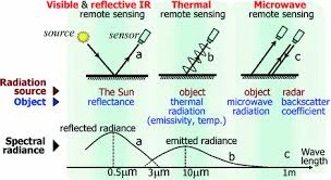
- Electromagnetic spectrum and radiation principles
- Types of remote sensing platforms and sensors (satellite, aerial, UAVs)
Module 2: Data Acquisition and Preprocessing
- Sources of remote sensing data
- Data acquisition techniques and platforms
- Preprocessing steps: radiometric and geometric corrections, image enhancement
Module 3: Remote Sensing Data Analysis
- Image classification techniques (supervised and unsupervised)
- Spectral indices for environmental monitoring (NDVI, EVI, etc.)
- Change detection and time-series analysis
Module 4: Applications in Environmental Monitoring
- Land use and land cover mapping
- Monitoring water resources and quality
- Vegetation analysis and forest monitoring
- Atmospheric studies and air quality monitoring
Module 5: Integrating Remote Sensing with GIS
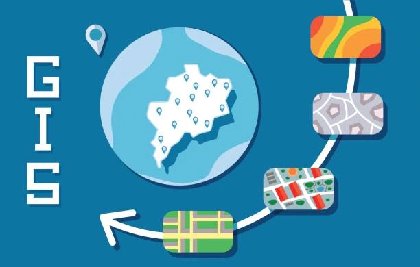
- Basics of Geographic Information Systems (GIS)
- Combining remote sensing data with GIS for spatial analysis
- Practical applications
Module 6: Advanced Topics and Emerging Technologies
- Hyperspectral and multispectral remote sensing
- Lidar and radar remote sensing applications
- Big data and machine learning in remote sensing
- Current trends and future directions in remote sensing for environmental monitoring
Module 7: Hands-On Projects and Case Studies
- Practical exercises in remote sensing data analysis
- Real-world case studies and project work
- Presentation and discussion of project results
Module 8: Interpretation and Presentation of Results
- Effective communication of remote sensing findings
- Visualization techniques for remote sensing data
- Preparing reports and presentations for stakeholders
Customized Training
This training can be tailored to your institution needs and delivered at a location of your choice upon request.
Requirements
Participants need to be proficient in English.
Training Fee
The fee covers tuition, training materials, refreshments, lunch, and study visits. Participants are responsible for their own travel, visa, insurance, and personal expenses.
Certification
A certificate from Ideal Sense & Workplace Solutions is awarded upon successful completion.
Accommodation
Accommodation can be arranged upon request. Contact via email for reservations.
Payment
Payment should be made before the training starts, with proof of payment sent to outreach@idealsense.org.
For further inquiries, please contact us on details below:


