Course Overview
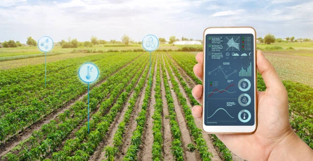
This course provides an in-depth understanding of how remote sensing technologies can be effectively applied in agriculture. Participants will explore the various techniques and tools used to collect and analyze remote sensing data, focusing on improving agricultural productivity, monitoring crop health, managing natural resources, and supporting sustainable farming practices. Through practical examples and case studies, learners will gain the skills needed to apply remote sensing in real-world agricultural scenarios.
Course Duration
10 Days
Who Should Attend
- Agricultural scientists and researchers
- Agronomists and farm managers
- Environmental consultants and natural resource managers
- GIS specialists and remote sensing professionals
- Students and academicians interested in precision agriculture
- Government and non-governmental organization (NGO) professionals working in agriculture and rural development
Course Objectives
By the end of this course, participants will be able to:
- Understand the fundamentals of remote sensing and its relevance to agriculture.
- Learn to use remote sensing tools and technologies for crop monitoring and management.
- Analyze remote sensing data to assess crop health, soil moisture, and other vital parameters.
- Apply remote sensing techniques to support precision agriculture practices.
- Evaluate the role of remote sensing in sustainable agriculture and natural resource management.
- Integrate remote sensing data with Geographic Information Systems (GIS) for comprehensive agricultural analysis.
- Understand the applications of satellite and drone imagery in agriculture.
- Develop skills to interpret and utilize multispectral and hyperspectral remote sensing data.
- Learn to design and implement remote sensing projects for agricultural purposes.
- Explore the latest trends and innovations in remote sensing technology for agriculture.
Course Outline:
Module 1: Introduction to Remote Sensing in Agriculture
- Overview of remote sensing technology and its applications in agriculture.
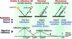
- Key concepts: electromagnetic spectrum, spatial resolution, spectral bands.
Module 2: Remote Sensing Platforms and Sensors
- Types of remote sensing platforms: satellites, UAVs, and airborne systems.
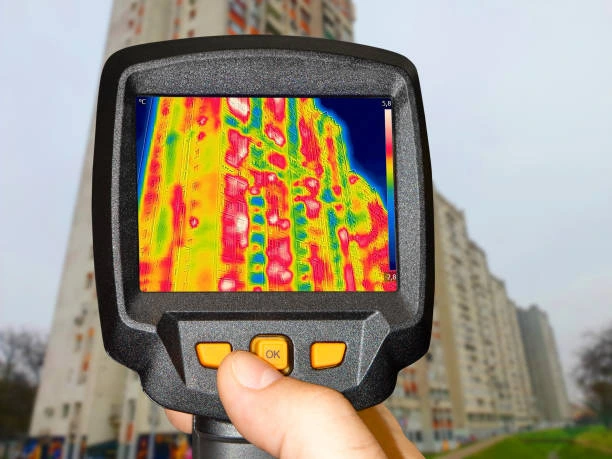
- Overview of different sensors used in agriculture: multispectral, hyperspectral, thermal.
Module 3: Crop Monitoring and Management
- Techniques for monitoring crop growth and development using remote sensing.
- Identifying crop stress, diseases, and pest infestations from remote sensing data.
Module 4: Soil Moisture and Irrigation Management
- Assessing soil moisture levels using remote sensing.
- Application of remote sensing in optimizing irrigation practices.
Module 5: Vegetation Indices and Their Applications
- Calculation and interpretation of vegetation indices (NDVI, EVI).
- Using vegetation indices for yield prediction and crop health assessment.
Module 6: Precision Agriculture and Variable Rate Technology (VRT)
- Integrating remote sensing with precision agriculture practices.
- Implementing VRT based on remote sensing data for site-specific crop management.
Module 7: Mapping and Monitoring Crop Water Use
- Estimating evapotranspiration using remote sensing.
- Monitoring crop water use efficiency and drought assessment.
Module 8: Use of Drones in Agricultural Remote Sensing
- Advantages and challenges of using UAVs in agriculture.
- Practical applications of drone-based remote sensing for crop scouting and mapping.
Module 9: Satellite Remote Sensing for Agricultural Policy and Decision Making
- Role of satellite imagery in supporting agricultural policy and planning.
- Case studies on the use of remote sensing in agricultural decision-making.
Module 10: Case Studies and Future Trends in Agricultural Remote Sensing
- Real-world examples of successful remote sensing applications in agriculture.
- Exploration of emerging technologies and future trends in the field.
Customized Training
This training can be tailored to your institution needs and delivered at a location of your choice upon request.
Requirements
Participants need to be proficient in English.
Training Fee
The fee covers tuition, training materials, refreshments, lunch, and study visits. Participants are responsible for their own travel, visa, insurance, and personal expenses.
Certification
A certificate from Ideal Sense & Workplace Solutions is awarded upon successful completion.
Accommodation
Accommodation can be arranged upon request. Contact via email for reservations.
Payment
Payment should be made before the training starts, with proof of payment sent to outreach@idealsense.org.
For further inquiries, please contact us on details below:
