Course Overview
Welcome to our comprehensive course on Introduction to GIS using ArcGIS and QGIS! In this course, we will take you on a participants through the fascinating world of Geographic Information Systems (GIS) and provide you with a solid foundation in two of the most widely used GIS software platforms: ArcGIS and QGIS.
GIS is a transformative technology that enables us to capture, analyze, and visualize spatial data, allowing us to gain valuable insights into the world around us. Whether you're interested in urban planning, environmental conservation, disaster management, or any field where location plays a crucial role, GIS will empower you to make informed decisions and solve complex problems.
Throughout this course, we will cover essential GIS concepts, such as spatial data types, coordinate systems, and data acquisition methods. You will learn how to manage and manipulate spatial data effectively, conduct spatial analysis to reveal meaningful patterns and relationships, and design professional-quality maps for effective communication of your findings.
Our hands-on approach will provide you with practical experience using ArcGIS and QGIS. Through step-by-step learning and real-world examples, participants will gain the confidence to navigate the software interfaces, perform essential tasks, and apply GIS techniques to real-world scenarios.
Course Duration
10 Days
Who Should Attend?
- Beginners and professionals who are new to GIS and want to develop foundational skills.
- Environmental scientists, urban planners, geographers, and professionals from related fields looking to incorporate GIS into their work.
- Students and researchers in disciplines that require spatial analysis and mapping.
- Anyone interested in understanding how to use GIS for spatial data analysis and decision-making.
Course Objectives
By the end of this course, participants will be able to:
- Understand the basic concepts and principles of GIS.
- Navigate and utilize the interfaces of ArcGIS and QGIS.
- Collect, manage, and manipulate spatial data.
- Perform spatial analysis and interpret the results.
- Create informative maps and visualizations to support decision-making.
- Apply GIS techniques to real-world problems and scenarios.
Course Outline:
Module 1: Introduction to GIS
- Definition and significance of GIS
- History and evolution of GIS
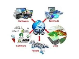
- Key components of a GIS
Module 2: Getting Started with ArcGIS
- Overview of ArcGIS software suite
- Installing and setting up ArcGIS
- Interface navigation and basic tools
Module 3: Getting Started with QGIS
- Overview of QGIS software
- Installing and setting up QGIS
- Interface navigation and basic tools
Module 4: Spatial Data Types and Formats
- Vector and raster data
- Common spatial data formats (Shapefiles, GeoTIFFs, etc.)
- Data sources and acquisition
Module 5: Data Management and Editing
- Organizing and storing spatial data
- Editing vector and raster data
- Attribute data management
Module 6: Coordinate Systems and Projections
- Understanding coordinate systems
- Common projections used in GIS
- Reprojecting spatial data
Module 7: Basic Spatial Analysis
- Overlay analysis
- Buffering and spatial joins
- Measuring distance and area
Module 8: Creating Maps and Visualizations
- Map design principles
- Symbology and labeling
- Creating and exporting maps
Module 9: Advanced Spatial Analysis Techniques
- Spatial statistics and modeling
- Network analysis
- Surface analysis and interpolation
Module 10: Applications of GIS
- Case studies in environmental management, urban planning, and other fields
- Best practices for applying GIS in various sectors
Module 11: Integrating ArcGIS and QGIS
- Data interoperability between ArcGIS and QGIS
- Transferring projects and workflows
Module 12: Project Work and Case Studies
- Hands-on project using real-world data
- Presentation and discussion of project results
Customized Training
This training can be tailored to your institution needs and delivered at a location of your choice upon request.
Requirements
Participants need to be proficient in English.
Training Fee
The fee covers tuition, training materials, refreshments, lunch, and study visits. Participants are responsible for their own travel, visa, insurance, and personal expenses.
Certification
A certificate from Ideal Sense & Workplace Solutions is awarded upon successful completion.
Accommodation
Accommodation can be arranged upon request. Contact via email for reservations.
Payment
Payment should be made before the training starts, with proof of payment sent to outreach@idealsense.org.
For further inquiries, please contact us on details below:


