Course Overview
This course offers a comprehensive introduction to Geographic Information Systems (GIS) with a focus on urban planning and development. Participants will learn how to leverage GIS tools and techniques to analyze spatial data, make informed decisions, and address urban planning challenges. The course covers topics such as land use planning, transportation systems, environmental management, and urban growth analysis. Through hands-on exercises and case studies, participants will gain practical skills in using GIS software to support sustainable urban development.
Course Duration
10 Days
Who Should Attend
- Urban Planners
- GIS Professionals
- Architects and Engineers
- Government Officials in Urban Development
- Environmental Planners
- Real Estate Developers
- Students and Academics in Urban Planning
- NGOs working on urban development projects
Course Objectives
By the end of this course, participants will be able to:
- To understand the fundamental concepts and principles of GIS in the context of urban planning.
- To develop skills in spatial data collection, management, and analysis for urban development.
- To apply GIS tools for land use planning, zoning, and environmental impact assessment.
- To enhance decision-making in urban planning through spatial analysis and modeling.
- To explore case studies and best practices in the use of GIS for sustainable urban development.
Course Outline:
Module 1: Introduction to Geographic Information Systems (GIS)
- Definition and concepts of GIS
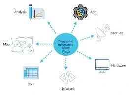
- Components of a GIS system
- Applications of GIS in urban planning and development
Module 2: GIS Tools for Urban Planning
- Overview of GIS software specifically designed for urban planning
- Installation and setup of GIS software
Module 3: Spatial Data Fundamentals for Urban Planning
- Types of spatial data (vector, raster)
- Coordinate systems and projections
- Data acquisition and sources for urban planning (e.g., aerial imagery, cadastral data)
Module 4: Data Management and Processing for Urban Planning
- Importing and exporting urban planning data
- Data cleaning and preprocessing
- Spatial analysis techniques for urban planning (e.g., land use classification, accessibility analysis)
Module 5: Urban Planning Applications of GIS
- Land use planning and zoning
- Transportation planning and traffic analysis
- Infrastructure planning (water, sewer, electricity)
- Urban growth modeling
Module 6: Environmental Planning with GIS
- Environmental impact assessment
- Sustainability analysis
- Natural hazard mapping and risk assessment
Module 7: Participatory Planning with GIS
- Community engagement and public participation
- Citizen science and GIS
- Online mapping platforms for urban planning
Module 8: 3D Modeling and Visualization for Urban Planning
- Creating 3D models of urban environments
- Visualizing urban development scenarios
- Virtual reality and augmented reality in urban planning
Module 9: Urban Analytics with GIS
- Big data and urban analytics
- Data mining and machine learning for urban planning
- Smart city applications and GIS
Module 10: Advanced Topics in GIS for Urban Planning
- Spatial decision support systems (SDSS) for urban planning
- Web-based GIS applications for urban planning
- Case studies of GIS applications in urban development
Customized Training
This training can be tailored to your institution needs and delivered at a location of your choice upon request.
Requirements
Participants need to be proficient in English.
Training Fee
The fee covers tuition, training materials, refreshments, lunch, and study visits. Participants are responsible for their own travel, visa, insurance, and personal expenses.
Certification
A certificate from Ideal Sense & Workplace Solutions is awarded upon successful completion.
Accommodation
Accommodation can be arranged upon request. Contact via email for reservations.
Payment
Payment should be made before the training starts, with proof of payment sent to outreach@idealsense.org.
For further inquiries, please contact us on details below:


